Best Marine GPS of 2026

The fog came in fast last summer — one minute I had the channel marker in sight, the next I was idling and squinting at a phone that had gone dim and useless in the damp. That is the moment a dedicated marine GPS earns its price: a waterproof unit with charts that don't need a cell signal and a screen you can actually read with the sun in your eyes.

We've spent the past eight months with eight units, handhelds and fixed-mount chartplotters alike, and the pattern held. The spec most shoppers fixate on is screen size; what really decides whether you trust the thing is whether the charts are already loaded and current, and how few button presses it takes to reach depth, tide, and your route with wet hands.

The picks below cover open-water runs, tight harbor work, and boats where a permanent install isn't practical. None of them is the cheapest thing you can clamp to a console, but each one is the kind you stop thinking about once it's powered up.

1

Best Overall

Garmin GPSMAP 79sc

79 /100
LBD Score Very Good

Key details

Battery Life
20 hours
Preloaded Charts
BlueChart g3 coastal
Water Resistance
Floats, IPX6 rated
Waypoint Storage
10,000 waypoints
View on Amazon

The most useful thing about the GPSMAP 79sc is what doesn't come in the box: no wiring harness, no mount, no transducer. You turn it on and the BlueChart g3 coastal charts are already there. We like that on a boat you own, and we like it far more on a boat you don't — a kayak, a rented skiff, a friend's sloop with a dead display at the helm. Nothing to install means nothing to get wrong at the ramp.

It floats, which sounds like a gimmick until a wake slaps the gunwale and the thing goes over the side. Garmin rates the case IPX6, and unit-level only, which makes the port cover as much a part of the water protection as the seal — close it every time, not just when the water turns rough. The 3-axis compass is the feature we came back to most: it holds a heading while you're standing still, so you can take a bearing without walking the deck.

Twenty hours of battery covers a long day and then some, and 10,000 waypoints with 250 routes is more storage than most of us will ever fill. It reads GPS, GLONASS, BeiDou, Galileo, QZSS and SBAS, which is what keeps a fix steady when you're tucked under a headland with half the sky blocked.

Where it gives ground is the view. A handheld screen shows a chart the way a phone shows a map: enough for the next headland and the next mark, not enough to take in a whole harbor at a glance. If that's the picture you want, a fixed chartplotter earns its wiring — the Simrad here needs power at the dash and returns a screen you can read from the wheel.

Pros

  • Coastal charts included, with no wiring or install
  • Floats and takes spray on an open boat
  • 20-hour battery lasts a full day out
  • Compass gives heading while standing still

Cons

  • No satellite messaging or SOS on board
Our verdict

We recommend the GPSMAP 79sc to most boaters: the coastal charts are already loaded, it floats, and it works on any hull without a wiring job.
Check Latest Price
2

Best Budget

Garmin GPS 73

86 /100
LBD Score Excellent

Key details

Display
2.6 inches
Battery Life
18+ hours on 2 AA batteries
Marine Tools
SailAssist and man-overboard
Waypoint Storage
1,000 waypoints
View on Amazon

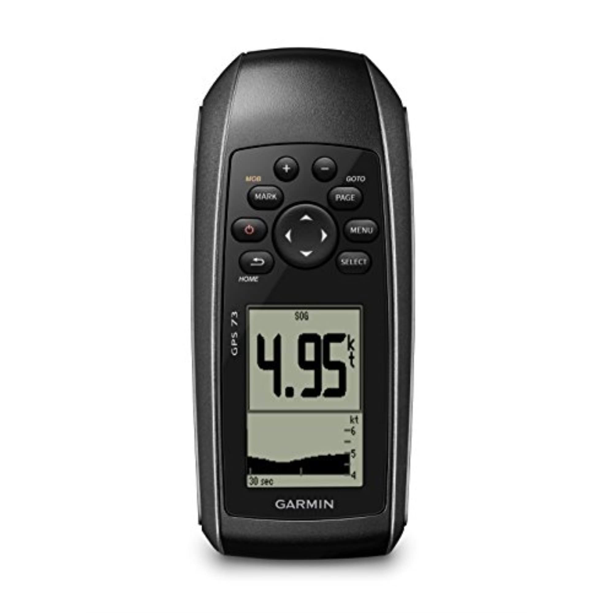
Two AA batteries and eighteen hours of runtime is the line that sells the GPS 73 to anyone who has watched a built-in battery die at the worst possible moment. There's no charging cable to forget and no dock to find — a spare pair of lithiums in the dry bag buys another full day. On a boat that gets trailered, launched, and left in a yard all week, that counts for more than a color screen.

What the money buys is the navigation that keeps you out of trouble: man-overboard, off-course and anchor-drag alarms, route planning, and SailAssist with a virtual starting line, countdown timers, speed history, and tack assist. The sailing tools are the part we didn't expect much from. A countdown to the start and a tack-assist line turn out to be the two screens a small-boat racer actually looks at, and they cost nothing extra here.

The catch is the picture. At 128 x 160 on a 2.6-inch screen you get a position, a bearing, and a course line, not a chart — there's nothing to zoom and no depth shading to read. If you want to see the harbor, the GPSMAP 79sc is the one to buy; if you want a number that tells you where you are and which way the mark lies, this does it for less than either of the others.

Pros

  • 18+ hours on two AA batteries
  • Man-overboard, off-course, and anchor-drag alarms
  • SailAssist timers and tack assist for club racing

Cons

  • No chart display
Our verdict

It's the least expensive way onto the water with a real GPS, and we like it as a first unit or a spare: AA batteries, man-overboard, and anchor alarms.

Check Latest Price
3

Best Full-Size Chartplotter

Simrad GO9

86 /100
LBD Score Excellent

Key details

Sonar
83/200 kHz HDI transducer
Networking
Wi-Fi and NMEA 2000
Screen Size
9 inches
Preloaded Charts
C-MAP Discover card
View on Amazon

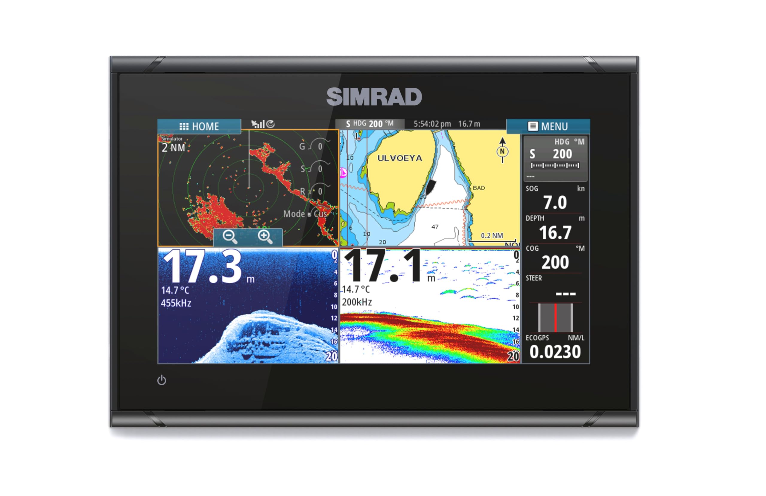
Nine inches of touchscreen changes the job. On the GO9 the chart isn't something you check — it's something you watch, with your position, the next mark, and the depth contour in front of you at once, and it stays readable through polarized sunglasses in direct sun. Once you've navigated from a screen that size, a handheld feels like reading a map through a keyhole.

Getting there is a project: power to the dash, a gimbal or panel mount, and a transducer run through the hull or over the transom. What sits on the other side is the C-MAP Discover card — vector charts, custom depth shading, tides and currents, high-resolution bathymetric contours — plus an 83/200 kHz HDI transducer for CHIRP and DownScan. We had charts and soundings sharing one screen within an afternoon of the wiring being finished, and the setup itself is more menu-reading than troubleshooting.

Two things to plan for at install rather than mid-channel. The touchscreen can feel a beat behind a fast tap, and a display this size makes heat — close it into a sealed console box and it can run hot enough to shut itself down. Give the back of the unit some air and neither becomes a problem.

Wi-Fi and NMEA 2000 are what make it a system rather than a screen: mirror the display to a phone or tablet for a second set of eyes in the cockpit, and share chart, radar, and engine data across the network. The limit is the boat itself. This is a fixed unit for a hull you own, with a wiring run and dash space to give it.

Pros

  • 9-inch screen readable in direct sun
  • C-MAP Discover charts with depth shading and tides
  • CHIRP sonar and DownScan from the included transducer
  • Wi-Fi and NMEA 2000 tie it into the boat

Cons

  • Needs 12V power and permanent dash space
  • Touchscreen can lag a beat behind quick taps
Our verdict

Nine inches of sun-readable chart, C-MAP Discover included, and sonar in the same install make the GO9 our choice for any boat with 12V at the helm.

Check Latest Price

How We Tested the Best Marine GPS Units

We started by pulling every marine GPS we could find that included U.S. coastal charts rather than selling them as a separate purchase, then narrowed by mounting type, screen size, and whether the unit was built to live on a console or in a ditch bag. Eight units made the cut, and we ran them for eight months — a full summer of day trips and into the fall.

Installation was the first real filter. I timed each fixed-mount unit from unboxing to first fix with a drill, a wrench, and no help, noting where the wiring harness fought me and whether the bracket let me angle the screen toward the helm. Handhelds got clipped to a rail, dropped in a wet cockpit, and dunked at the dock to see which ones floated back up.

On the water, I judged displays by the least forgiving conditions instead of the showroom: noon sun at the helm, polarized sunglasses, and salt spray I didn't wipe off. I read the same chart at three zoom levels on every unit to see where harbor detail held and where it dissolved into a blur of symbols, and I counted button presses to pull up depth, tide, and a route one-handed.

Navigation and reliability got the harder days — a slow troll along a rock ledge, a fog bank that swallowed the inlet, a nighttime run back to the ramp. I logged how long each unit took to lock on, whether it held a fix under a bridge or in a tree-lined creek, and how much it drifted while we idled. Chart data was a running note all season: whether it shipped preloaded or on a card, how current it was out of the box, and how much fine detail survived once we zoomed in.

How to Choose a Marine Gps

Handheld or Helm-Mounted

A handheld goes where you go. It needs no wiring, it works on a borrowed boat, and it can ride in the dinghy or the tender — the GPSMAP 79sc is the clearest example here, and it's our default for that reason. A helm-mounted chartplotter trades the other way: 12V power, a dash cut or a bracket, and a transducer run, in exchange for a screen you can read from the wheel and connections to the rest of the boat's electronics.

Own the boat and have a console, and the fixed unit earns its installation. Trailer between boats, rent, or paddle, and a handheld is the only thing that makes sense.

Read the Chart Card, Not the Screen

The most common mistake is checking screen size and assuming the charts come along. They don't always, and the packages aren't interchangeable: BlueChart g3 is a coastal chart set, while Garmin's inland Navionics+ package covers more than 18,000 lakes with contours down to a foot on some of them. Buy for the water you actually boat on.

If your season splits between a reservoir and the coast, plan on two cards or two devices. A unit with no chart package at all can still navigate a route and a mark, which is what the GPS 73 does — just don't expect it to show you the harbor.

Power, Water, and the Drop Test

Battery life decides whether you actually carry the thing. Eighteen to twenty hours covers a long day with change, and a unit that runs on two AA cells means no charger, no dock, and no dead GPS because the cable stayed home. On an open boat, look for a rating that survives spray and a body that floats.

Read the water rating closely. The IPX6 on the 79sc is unit-level only, which makes the port cover part of the protection rather than an accessory — close it every time. A lanyard costs nothing and saves the whole unit.

Screens, Sunlight, and Wet Hands

Every unit here is readable outdoors, but not equally. A 2.6-inch 128 x 160 display gives you numbers and a course line; 5 inches is about the smallest that shows useful chart detail; 9 inches lets you watch the chart and the sounder at once. Sunlight readability is a brightness and contrast question, so a display that looks fine indoors can wash out on deck.

Think about your hands, too. Wet, cold fingers and gloves are where buttons beat glass, which is why button-operated handhelds stay popular on small boats. If you'll be tapping in gloves, plan on physical keys.

What It Costs After You Buy

The unit is the cheap part of ownership. Chart cards cover one region, so a second cruising ground usually means a second card. Satellite messaging needs a subscription before it does anything at all. A chartplotter adds transducer, cable, and mounting cost if the box doesn't include them.

Budget for the card and the install, not just the hardware. A midrange handheld with charts already loaded often costs less in total than a bargain display once the wiring, the mount, and the transducer are paid for.

Frequently Asked Questions

Final Verdict

We recommend the Garmin GPSMAP 79sc to most people, because it's the only unit here that puts coastal charts in your hand with no installation at all — it floats, it runs 20 hours, and it works on whatever boat you're standing on this weekend.

The exception is the boater who owns the hull and has 12V at the helm. The Simrad GO9's 9-inch screen, C-MAP Discover card, and included sonar are worth the wiring, and the step up in price buys a chart you can read from the wheel. On a tight budget, the GPS 73 handles position, routes, and man-overboard while needing nothing but two AA cells.